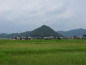
Present view of the area where “Yanonosho Reimyo Nishikata” was located
Sometimes we need to visit, see, and feel a place to actually understand it. The case is the same with Shoen (manors). The Toji Hyakugo Archives include a large number of Shoen-related documents, but it is difficult to actually understand what they were like by merely reading the text written on the documents. It is also important to visit the place, walk across the area, and see the scenery of the area with one’s own eyes. The three series starting today will share with you a visit to Yanonosho(矢野荘), Harimanokuni(播磨国) (the present southwestern Hyogo Prefecture).
Yanonosho was located in the present Aioi, and the range of the Shoen almost equaled that of the present 相生市 (Aioi City) (Google Maps).
The Shoen was divided into four districts: “Bechimyo”, “Reimyo Nishikata”, “Reimyo Higashikata”, and “Urabun”. One Shoen was divided and donated by more than one lord.
“Bechimyo” was dominated by the Nanzenji temple. “Reimyo” and “Urabun” had been dominated by Fujiwarano Takanobu, a known poet and painter, and his descendants. In 1298, “Reimyo” was divided into the eastern part and the western part. The Ebina clan as the Jito (local master of manor) did not pay land tax properly to the Fujiwara clan. The two clans tried to resolve the dispute by sharing the western part to the Fujiwara clan and the eastern part to the Ebina clan, and promising that the two parties would not interfere with each other’s portions.
What area did the Toji temple dominate, since what time?
In the medieval Japan, different levels of rights pertained to the same land. In Yanonosho, Retired Emperor Go-Uda possessed the highest level of right, and was capable of affecting lower rights. It seems that Retired Emperor Go-Uda gave up on the Fujiwara clan, and thus donated to Toji “Reimyo Nishikata” in 1313, and “Shigefuji Myo”, a part of “Reimyo”, and “Urabun” in 1317. Thus Toji became the ruler of “Reimyo Nishikata” and “Urabun”, which used to be dominated by the Fujiwara clan.
In the present Aioi, which respective parts correspond to “Betsumyo”, “Reimyo Nishikata”, “Reimyo Higashikata”, and “Urabun”?
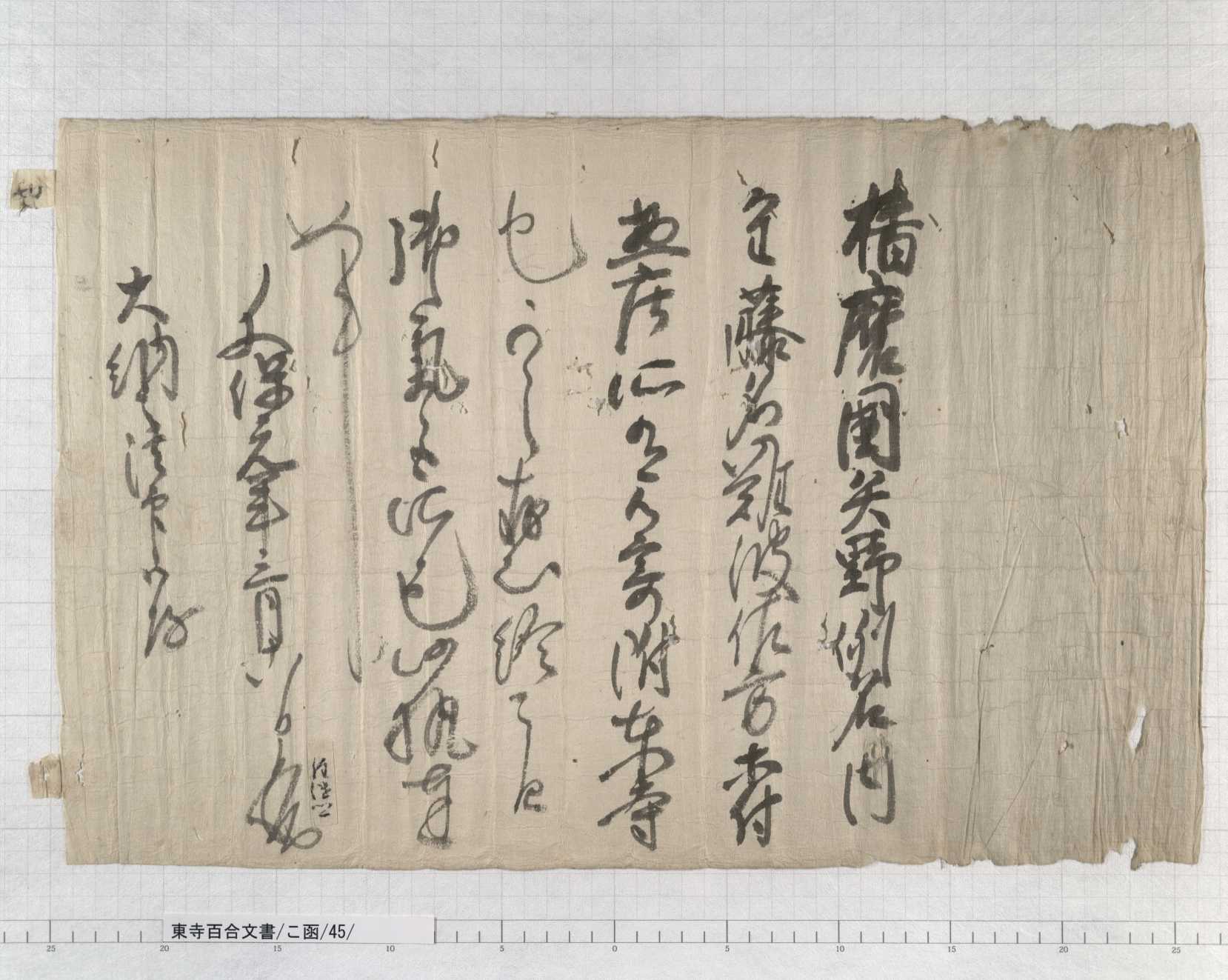
Let’s look at “Urabun” at first, because it is relatively easy to find. The document above is the letter of donation in 1317, which was mentioned above. At the beginning of this document, it says “播磨国矢野例名内重藤名 (“Shigefuji Myo”, a part of “Reimyo” in Yano, Harimanokuni)、難波・佐方等”. These “難波 (Naba)” and “佐方 (Sagata)” correspond to Urabun. Both Naba and Sagata still remain in the land names, along the coast of 相生湾 (Aioi Bay) (Google Maps). Toji was later robbed of Urabun by the Ebina clan as the Jito, and gave up collecting land tax in around 1400.
Subsequently, let us look for the locations of Reimyo Nishikata, Reimyo Higashikata, and Betsumyo. The documents below answer these questions:
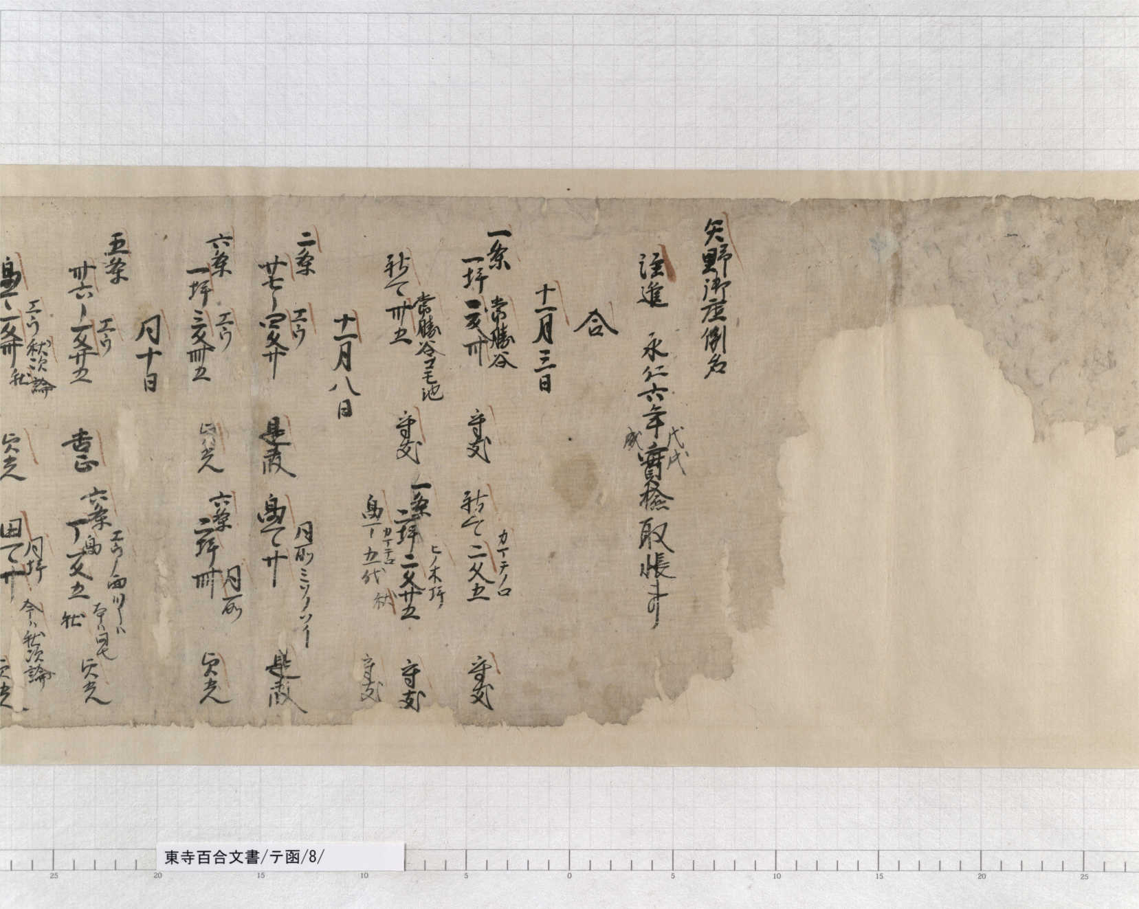
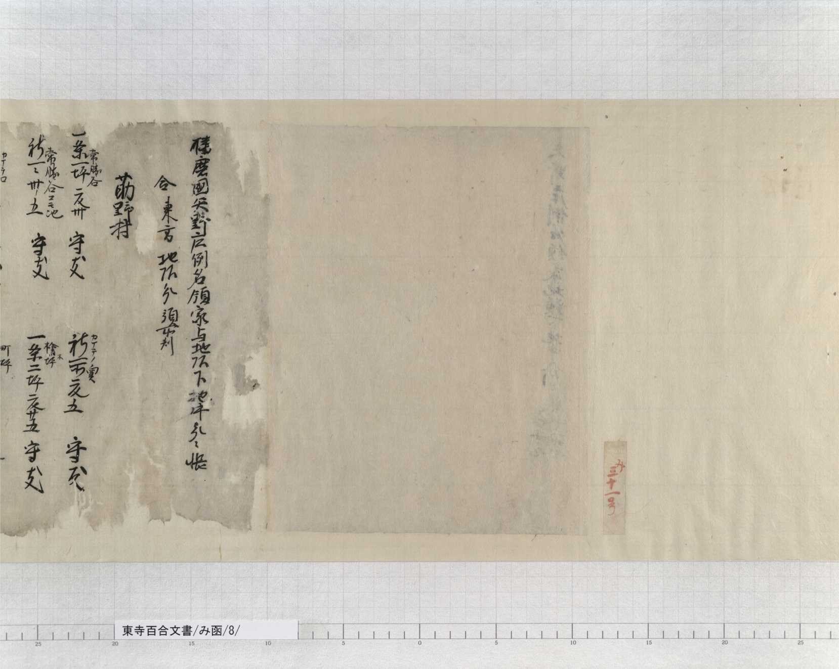
The documents above record the results of the division of Reimyo in 1298, which was mentioned earlier. Now that the land was divided, the shares of each party had to be clarified. The Fujiwara clan and the Ebina clan conducted Kenchu (land inspection), and recorded the conditions of farm fields. The Box Katakana TE, No. 8 document indicates the range of the entire Reimyo, while the Box Hiragana MI, No. 8-1 document shows the scope of Reimyo Higashikata. Unfortunately, no document indicating the range of Reimyo Nishikata remains to today. However, we can tell the range of Reimyo Nishikata by subtracting the areas recorded in the Box Hiragana MI, No. 8-1 document from the content of the Box Katakana TE, No. 8 document. Comparison of the two documents uncovers that Reimyo was roughly divided into the western part and the eastern part along the 矢野川 (Yanogawa) river (Google Maps).
The case was a little more complicated with Betsumyo. In the Box Katakana TE, No. 8 document, notes were indicated for the land areas the affiliations of which were argued, whether Reimyo or Betsumyo. In particular, arguments did not cease around the borders between Reimyo and Betsumyo. By extracting the land areas indicated with notes, the rough borders between Reimyo and Betsumyo can be known. At the same time, the Box Katakana TE, No. 8 document does not indicate land areas outside Reimyo. Therefore, the areas that were located near the borders, but are not recorded in the Box Katakana TE, No. 8 document, can be considered as the range of Betsumyo. Based on the rationale above, Betsumyo was located around the present 小河 (Ogo) (Google Maps). It was adjacent to Reimyo Nishikata on the north and south, and to Reimyo Higashikata on the east.
In conclusion, let’s review the geography. Urabun was located along Aioi Bay. Reimyo Nishikata, Reimyo Higashikata, and Betsumyo were located in the areas excluding Aioi Bay. Roughly along the Yanogawa, the eastern part corresponded to Reimyo Higashikata, and the western part to Reimyo Nishikata. Reimyo Nishikata was divided into the northern district and the southern district, with Betsumyo located in between, which was located around Ogo.
(Kaji, Historical Materials Section, the Kyoto Institute Library and Archives)