“Documents” contain not only text. Today, let’s look at how history is recorded in drawings.
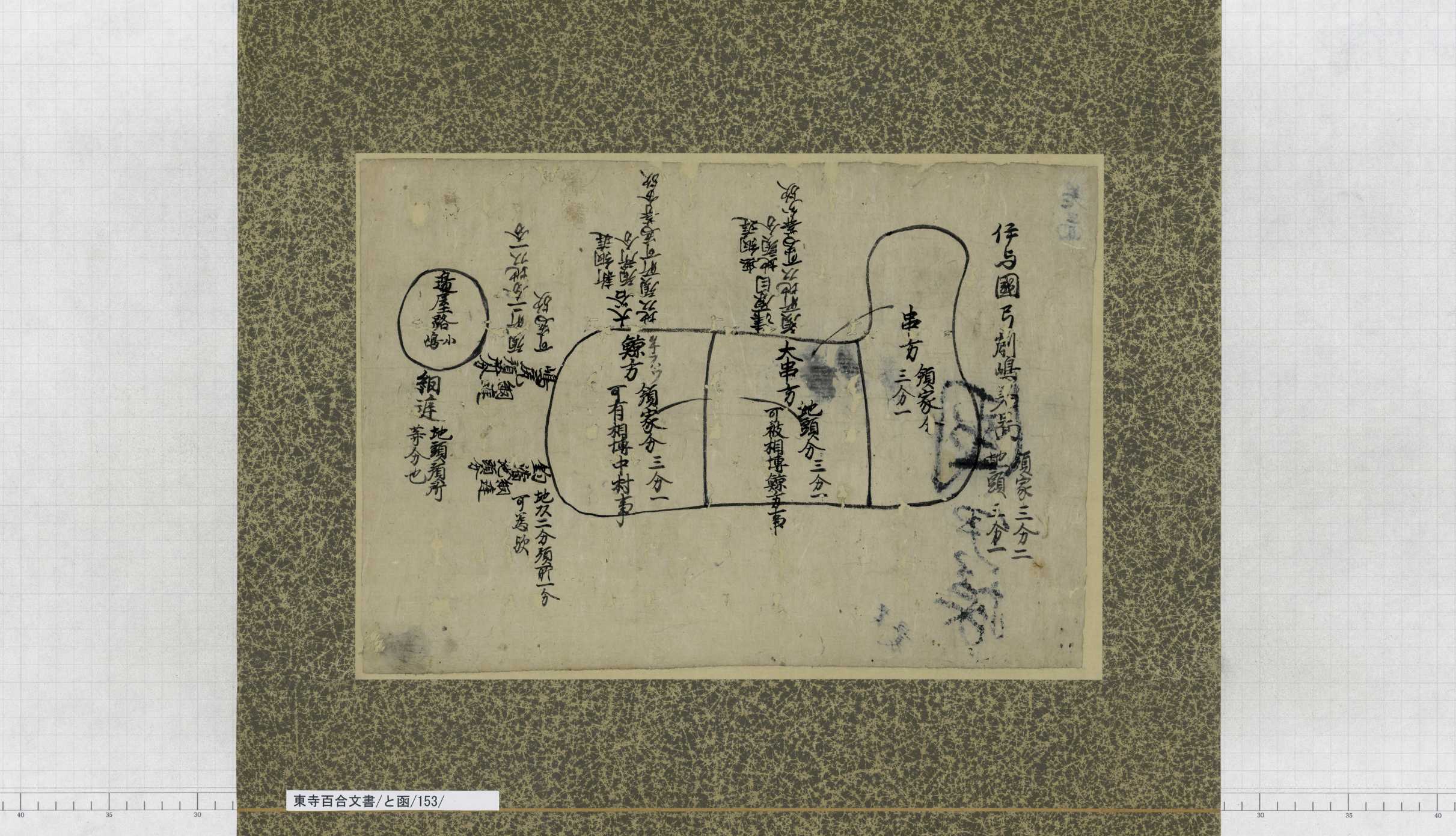
“Iyonokuni Yugeshimanosho (伊予国弓削島荘)” was an area known for salt production, and had been widely known as a “Shoen (manor) of salt”. This manor is located on the Yugeshima island(弓削島) and the Hyakkanjima island(百貫島), Kamijima-cho(上島町), Ochi-gun(越智郡), Ehime(愛媛) in the present day, at the easternmost tip of the Geiyo Islands that range from Hiroshima Prefecture to Ehime Prefecture (Google Maps ). Turn the Sashizu (map) north up, and compare it with the present map (Geospatial Information Authority of Japan ). The L-shaped island is Yugeshima, and “辺屋路島 (Heyajijima)” drawn to the northeast of Yugeshima equals to today’s Hyakkanjima. The shapes are simplified, but clearly represent the geographic characteristics of the two islands.
The history of Yugeshimanosho as a domain of Toji started in 1239, when Senyomon’in Kinshi (宣陽門院覲子), the loved daughter of Emperor Go-Shirakawa (後白河天皇), contributed her estate. Just around those days, Jito (local masters of manors) were becoming increasingly aggressive, and the invasion of manors by Jito was making constant trouble. Although reconciliation was reached in 1259, it seems that disputes did not cease. For the purpose of achieving stable manor management, Toji divided its land into the share for Toji as the Ryoke (“領家” owner and lord of manors) and the share for the Jito, and stipulated that the two parties should not interfere with each other’s shares, thereby seeking resolution of the issue. This process of dividing land for the purpose of resolving trouble between Ryoke and Jito is called “Shitaji Chubun (下地中分)”.
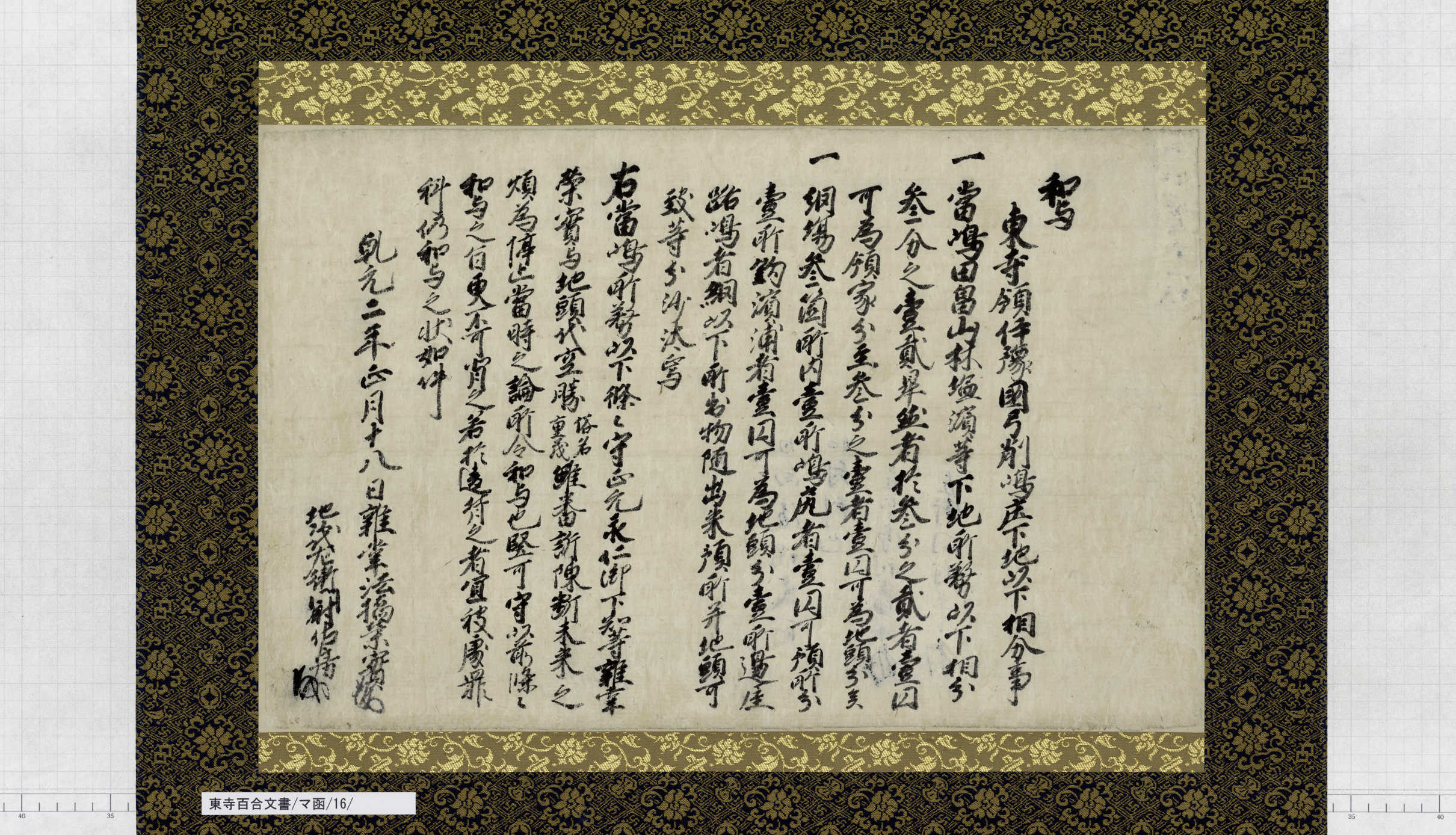
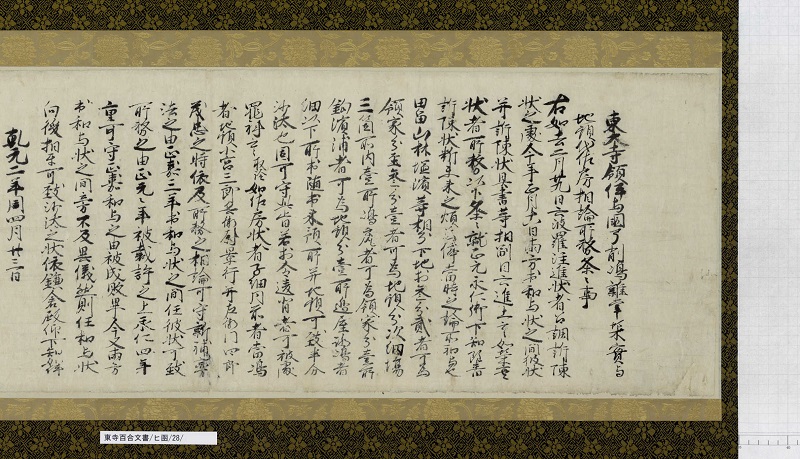

The two documents above indicate that an agreement for the division of land was made between the Zassho (“雑掌” local representative who collected land tax for Toji) and the Jito-dai (deputy Jito) (Item 16 of Box-MA(Katakana)), and that the agreement was authorized by the Kamakura bakufu (“鎌倉幕府” Kamakura shogunate) a few months later (Item 28 of Box-HI(Katakana)). Yugeshima was divided into three parts. The central part of the island called “Ogushi-kata (大串方)” was determined as the share for the Jito, and the northern part (“Kushi-kata (串方)”) and the southern part (“Kujira-kata (鯨方)”) that sandwiched the Jito’s share belonged to the Ryoke. The map above shows these divided shares. While this map is not dated, the history of disputes suggests that the map was formulated following the Shitaji Chubun in 1303.
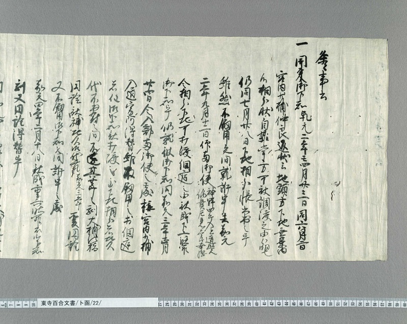
However, the division of the island did not proceed successfully. The document above states that the two parties did not actually reconcile, and that “Boji (牓示)”, signs for fixating boundaries, were not installed even in 1307 (Item 22 of Box-TO(Katakana)). It is believed that the actual division process was finally undertaken in around 1313, though the year varies among different theories.
(Kaji, the Kyoto Institute, Library and Archives)