The Toji Hyakugo Archives include several documents titled “Sashizu (差図)”. This term sounds unfamiliar. What does it mean?
For example, the figure below is called “Settsunokuni Taruminosho Sashizu”. It seems like a kind of map. Let’s have a close look at it.
In medieval Japan, figures were often drawn to identify the details of Shoen (manors). Figures of Shoen were drawn for diverse purposes and in various processes, for example, for clarifying who should pay land tax (rice and harvest) and how much the tax should be, and for investigating local situation when a dispute occurred concerning the distribution of water channels to farm fields. Such figures are called “Shoen Ezu (lit. pictorial diagrams of manors)”. Among other Shoen Ezu, plane drawings that depict farm fields and water channels with simplified black ink lines are called “Sashizu”.
“Sashizu” not only signifies Shoen Ezu, but also collectively refers to the premises of residences, temples and towns, the layouts of tools and seats for Buddhist services, and so on.
A sheet of Ezu or Sashizu often reveals the domain of a particular Shoen, life of people living there, and many other historical facts. Here, leaving any academic complexities behind, let’s enjoy visiting the world drawn in Sashizu.
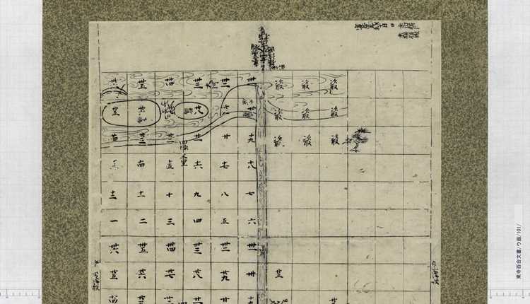
Look at the photos above. This Sashizu depicts Settsunokuni Taruminosho, a manor that was located in the present Osaka, just around the border between Suita and Toyonaka. It was drawn in October 1463, about 550 years ago.
This Sashizu was drawn in Taruminosho when “Kenchu (検注)” was conducted. “Kenchu” refers to measuring land area and designating the owner of the measured land, for the purpose of identifying who should pay land tax (rice and harvest) and how much the tax should be.
Care should be taken as to the directions of the map. In this Sashizu, the bottom is directed to the north.
It seems that this type of manor diagrams were folded out and seen from all sides. A close look at this photo shows that characters and illustrations were entered in various directions, to the top and bottom and to the left and right.
At the top of this drawing, the “Mikunigawa (三国川)” river (present Kanzakigawa (神崎川)) runs from left to right. The road along the river is marked as “三国堤 (Mikuni Tsutsumi (tsutsumi: bank))”. Mikunigawa runs through the north of the Yodogawa river, and flows into the Osaka Bay.
Taruminosho was a manor that covered the northern coast of Mikunigawa. The place name “Mikuni (三国)” remains to date in this area.
Mikunigawa is depicted at the top of this diagram, and something of a crescent shape floats in the top left corner. Let’s turn it upside down:
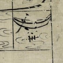
It is a picture of a boat – a simple vessel just like a leaf boat, and one oar. In those days, ferry boats traveled across Mikunigawa, so this picture may have depicted one of them.
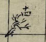
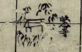
Trees are also drawn here and there. There is one in the top right of the drawing (A), one on another river that runs at the center from north to south (B), and in the bottom left of the drawing (C). A closer look shows that things are also drawn around the temple (帰命寺 (Kimyoji)) and around the shrine in the bottom left area of the photo.
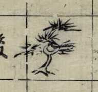
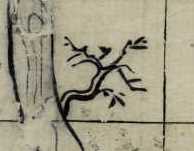
Tree (A) has a thick trunk, and thin leaves that stretch vertically on horizontally spreading branches. It may be a grand pine tree.
Tree (B) has branches that resemble those of (A), though without many leaves.
Tree (C) has branches that grow seemingly upward, in a manner different from those of (A) and (B).
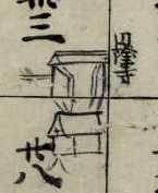
Among the three buildings, Kimyoji is drawn to the left, above the other two. It seems that a bamboo bush surrounds this temple. Bamboo bushes may have always surrounded temples, long time ago and still in the present days.
Near the shrine building is drawn a Torii gateway to show that it is a shrine. In front of the shrine building, something like a hedge is depicted.
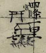
To the right of the shrine is depicted another temple, marked as “円隆寺 (Enryuji)”. According to “吹田市史 (History of Suita City)”, Enryuji had a close relationship with the Toji temple, and was the main place of worship in Taruminosho. A gate with doors is drawn, with a part of earthen wall, suggesting a different atmosphere from that of Kimyoji.
While the buildings of the temples and the shrine are drawn in the same manner, items around them clearly indicate their characteristics. All items in the drawing seem simple, but are actually drawn carefully and skillfully.
Ancient documents are usually filled with unfamiliar characters, yet such interesting illustrations are sometimes found!
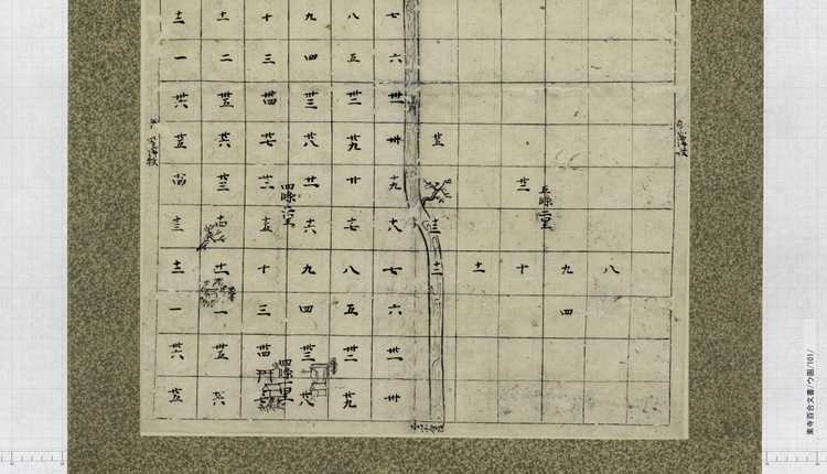
Last but not least, let’s look at the islands that are located in Mikunigawa.
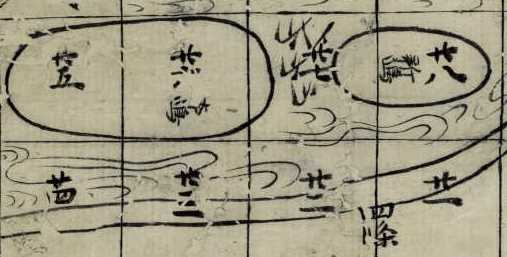
Two islands are drawn. The larger one is marked as “本嶋 (Honshima) (lit. main island)”, and the smaller one as “新嶋 (Shinsima) (lit. new island)”. Between them are drawn things that look like plants or trees. Are the reeds growing in the river? Well, the true answer is … it’s in another document in the Hyakugo Archives! Look forward to the next story.